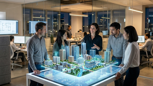
The commercial real estate sector and urban planning committees are currently undergoing a structural evolution driven by spatial computing and digital twin generation. For decades, architects, property developers, and city planners relied on slow, expensive manual methods to visualize physical spaces. Constructing physical scale models or rendering detailed architectural mockups required significant financial resources and extensive labor hours. Today, this traditional workflow is rapidly shifting. Innovations from platforms like Neural4D are allowing development firms to bypass traditional constraints by turning standard photographs and drone footage into precise, highly detailed three-dimensional models in a matter of minutes.
This rapid digitization of physical environments represents a fundamental shift in how cities and properties are planned, marketed, and maintained. Neural4D was developed collaboratively by research teams at Nanjing University, DreamTech, Oxford University, and Fudan University. Utilizing proprietary Spatial Sparse Attention (SSA) technology and the Direct3D-S2 framework, this platform delivers advanced AI 3D reconstruction technology that integrates directly into commercial design software. The ability to automatically generate millimeter-accurate digital replicas empowers urban developers to reduce rendering costs while dramatically improving presentation quality for investors and prospective buyers.
The Financial Impact of Digital Twins in Real Estate
Understanding the true value of spatial computing requires looking closely at the financial mechanics of property development and sales. In commercial real estate, visualization is directly tied to capital acquisition. Investors demand high-fidelity representations of proposed projects before committing funds.
Historically, creating a photorealistic virtual tour of an unbuilt or recently renovated property was a massive undertaking. Teams of 3D artists would spend weeks carefully modeling every wall, fixture, and piece of furniture. If an investor requested a design change, the entire rendering process had to begin again, causing expensive project delays.
Automated spatial reconstruction solves this bottleneck entirely.
- Accelerated Property Marketing: Real estate agencies can now use simple video walkthroughs captured on mobile devices to generate fully interactive 3D virtual tours. Prospective buyers can explore properties remotely with complete spatial awareness, which directly increases conversion rates for international or out-of-state buyers.
- Reduced Visualization Budgets: By automating the heavy lifting of geometric modeling, architectural firms can reallocate their visualization budgets. Human designers can focus on lighting, aesthetic mood, and interior design choices rather than manually building structural meshes.
- Iterative Design Flexibility: When a digital twin is generated rapidly, architects can present multiple variations of a space to a client in a single afternoon. This flexibility improves client satisfaction and prevents costly late-stage revisions during the actual construction phase.
Building the Smart Cities of Tomorrow
Beyond individual property sales, the implications for urban planning are massive. The concept of a smart city relies entirely on having an accurate, constantly updated digital representation of the physical environment. City planners use these massive digital twins to simulate traffic patterns, analyze the impact of new high-rises on natural light, and plan emergency response routes.
Generating a digital twin of an entire metropolitan district used to require highly specialized LiDAR scanning equipment mounted to aircraft. The data processing alone could take months. With modern deep learning algorithms, municipalities can process standard drone videography to achieve similar results at a fraction of the cost.
- Infrastructure Monitoring: Civil engineers can deploy drones to record video of aging bridges and highway overpasses. The AI processes this footage to create an exact 3D replica, allowing inspectors to identify micro-fractures or structural fatigue from their offices.
- Environmental Simulation: Urban planners can overlay flood data or heat map projections onto accurate city models to determine which neighborhoods are most vulnerable to extreme weather events.
- Community Engagement: When proposing new public transit lines or zoning changes, city councils can present citizens with interactive 3D models of the proposed changes. This transparency builds public trust and reduces friction during community town hall meetings.
“The integration of machine learning into spatial reconstruction shifts urban planning from reactive management to proactive simulation. When we can accurately visualize the physical world in real-time, we can design much safer and more efficient cities.”
The Open Source Ecosystem Supporting Innovation
While massive commercial entities and governments are utilizing these tools on a macro scale, the foundational technology is also thriving within open-source communities. The democratization of 3D generation means that independent researchers, students, and hobbyists now have access to the exact same rendering capabilities as large corporations.
This accessibility has sparked a wave of collaborative engineering. Independent designers frequently scan physical objects, optimize the meshes, and share them globally. For example, individuals working on community-driven architectural projects can access resources like the DIY3D open model repository to find pre-optimized, structurally sound components. These shared digital libraries are accelerating innovation by ensuring that designers do not have to constantly reinvent the wheel when populating their digital environments. The collective effort of these communities serves as a massive testing ground for new optimization techniques that eventually find their way back into enterprise software.
Key Considerations for Enterprise Implementation
For property developers and civil engineering firms looking to integrate these deep learning pipelines into their operations, several technical factors must be addressed to ensure success.
Software Ecosystem Integration: The output generated by the AI must be immediately compatible with standard architectural software like AutoCAD, Revit, and Rhino. The meshes must maintain precise real-world scale and export in universally accepted formats to prevent workflow disruptions.
Data Security Protocols: When scanning sensitive government buildings, proprietary corporate facilities, or private residences, data privacy is non-negotiable. Enterprise solutions must offer robust encryption and local processing options to guarantee that sensitive spatial data does not leak into public datasets.
Mesh Optimization Standards: A city-scale digital twin contains billions of polygons. The reconstruction engine must be capable of aggressive, intelligent decimation. This ensures that the generated models can be loaded and viewed smoothly on standard hardware without requiring massive supercomputers for playback.
The transition from flat two-dimensional blueprints to fully interactive three-dimensional digital twins is reshaping how the physical world is constructed. The automation of this process through advanced deep learning networks is removing the final barriers to mass adoption. By embracing these powerful visualization tools, real estate professionals and urban planners are improving their operational efficiency and fundamentally enhancing how they communicate spatial concepts to stakeholders. The physical spaces of the future will all be built, tested, and perfected in the digital world long before the first shovel hits the dirt.